Welcome to our maps page. We understand that geography can be confusing. That being said it is often pivotal to understanding events. If we are talking about a certain place we will try to have maps posted so that you don't get lost in the woods.
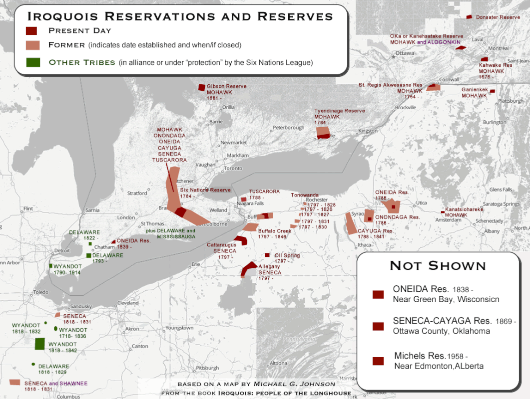
This shows the current land tracts control by governments of the Six Nations as well as the original sizes of the reservations when they were established by treaty. Unlike many other ethnic people of the continent many of the Haudenosaunee were able to remain in the northeast. Although not all.
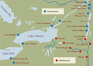
A map of French and British forts and posts in Iroquois Territory in 1755
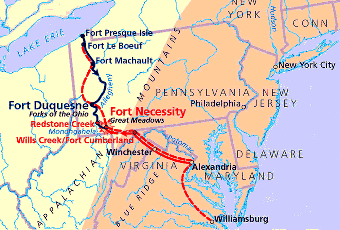
Washington's path to the Ohio Country in 1754
|
A timeline of Iroquois expansion up until the French and Indian War.
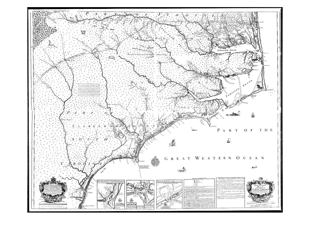
North Carolina in 1733. Shortly after the Tuscarora War. Many of the Native villages and towns are labeled.
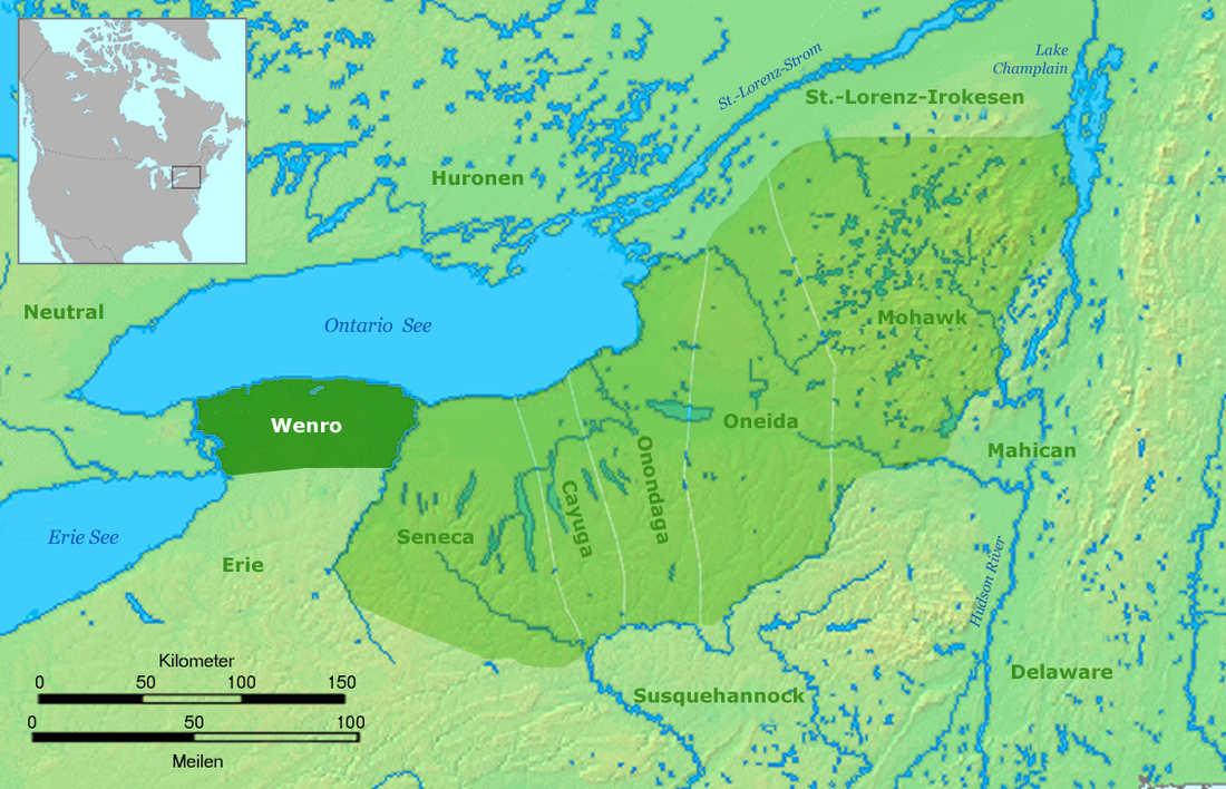
The Wenro Nation compared to its neighbors in 1638.
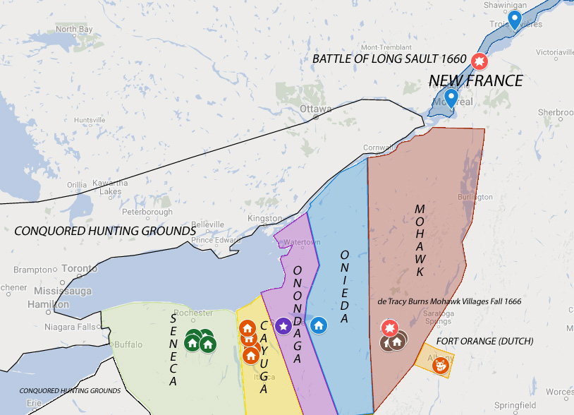
Towns and Territory of the Five Nations in 1660.
|

Cartier's Second Voyage to North America. Showing his journey down the St. Lawerence River.
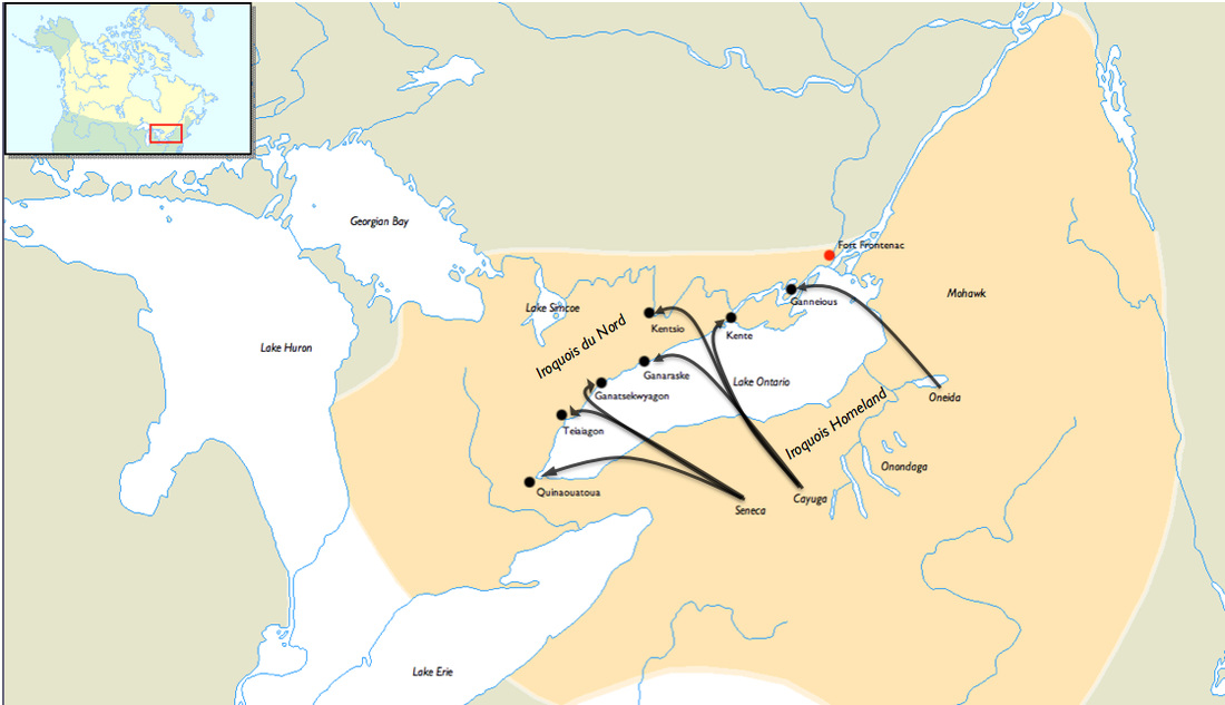
Iroquois settlements on the north side of Lake Ontario. 1665-1701
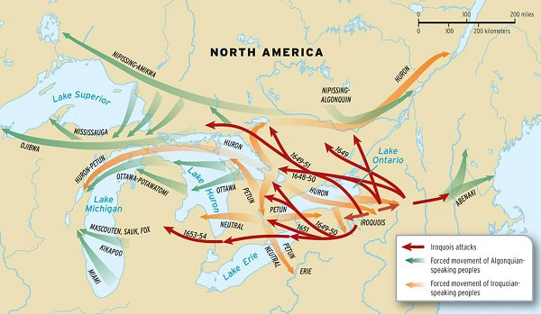
Haudenosaunee raids in the early 17th century.
|

An English map published in 1755.
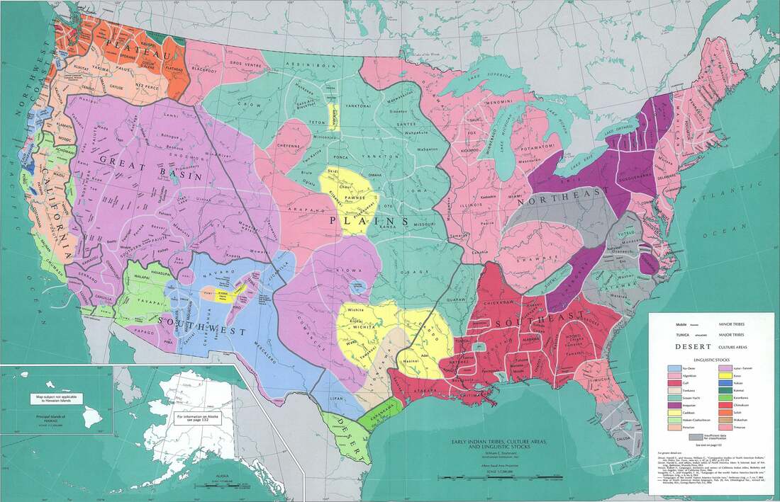
A map of the estimated locations of Native Nations and tribes in the 16th century coded by language families.
